| | Home | Resources | Schools Programme | Teachers | Site help | About us | Contact us | |
| You are here: Home > Resources > King James VI > 17th Century Scotland |
|
||||
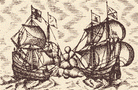
Map of the Kingdom of Scotland, 1610This map was made by the famous English cartographer, John Speed, and was published in an atlas called The Theatre of the Empire of Great Britain in 1612. Speed combined surveys and historical research to create illustrated maps that were both informative and decorative works of art. The map shows Orkney and part of Ireland as well as the Scottish mainland, and includes engravings of King James and his wife, Anne of Denmark, with their respective royal coats of arms, engravings of Henry, Prince of Wales and Ireland, and Charles, Duke of York and Albany. The map includes decorative vignettes of ships and sea creatures. Explore the map in a new window. 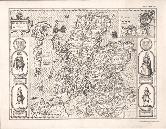
|
||||
|
King James is dressed in padded breeches and a doublet with a low waist, tight fitted and stuffed at the stomach and across the shoulders. He wears a plume in his hat and his band [collar] is worn over his cape or cloak, which is attached to his doublet. His legs are covered with stockings or hose to above the knee, supported by a garter, and a rosette hides the instep fastening on his shoes. Queen Anne wears a pointed stomacher, boned to achieve the rigid elegance expected of court dress. At this period skirts with no front opening were called petticoats. Women would wear a number of petticoats at the same time, depending on the time of year, with flannel petticoats being particularly popular in winter. The word 'skirt' was used to refer to the edging at the bottom of the petticoat, often decorated with braid and just above the hem. The Queen wears a lace-edged band (collar) over her dress and her hair is arranged over a fontange [a tall head-dress]. She wears pearls around her neck and carries a fan and a hankerchief. (National Records of Scotland reference: RHP 13899/1. Reproduced by permission of the National Library of Scotland.) |
||||
Pont's Map of Peebles-shire, 1654The image below shows part of a map of Tweeddale, an old name for Peebles-shire. It follows the course of the River Tweed and Eddleston Water through lands between Teviotdale and Ettrick Forest. It was drawn by Timothy Pont in 1608 and published in Blaeu's Atlas in 1654. Pont graduated from St Andrew's University in 1583 and became a famous geographer and cartographer. During his lifetime he surveyed large areas of Scotland and produced seventy-seven maps. 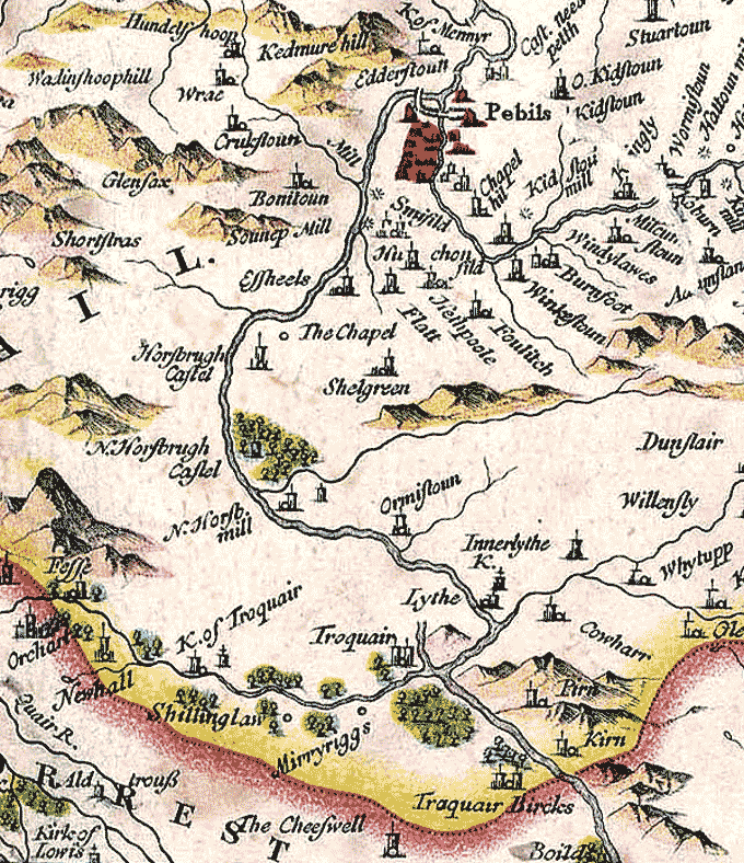
(National Records of Scotland reference: RHP 1096/3. Reproduced by permission of the National Library of Scotland.) |
||||
|
|
 Seventeenth Century Scotland
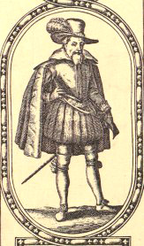
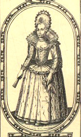 These engravings of the King and Queen provide a glimpse of the court fashion of the period. At the time of the Union of the Crowns, wealthy people devoted a great deal of effort to the way they dressed. Members of the royal court and people who moved in high society wore luxurious clothing. Many of the styles were lavish and flamboyant to reflect the latest styles and colours.